

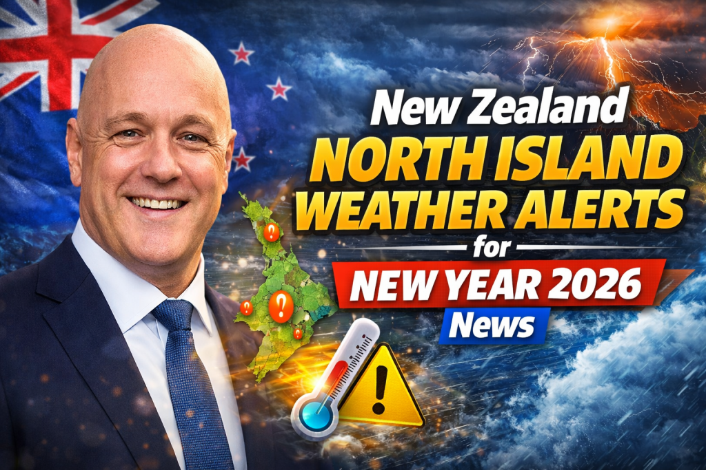
A severe thunderstorm watch blankets much of New Zealand’s North Island on New Year’s Eve 2025, with intense downpours, hail, and gusty winds threatening celebrations from Whangārei to Wairarapa. MetService warns of 25 to 40 millimeters of rain per hour in spots, risking flash floods, slips, and hazardous driving as a slow-moving low-pressure system lingers. Holiday hotspots brace for disruptions, but drier conditions loom post-midnight into 2026.
New Zealand rings in 2026 amid turbulent weather, with North Island revellers facing showers and storms primed by converging winds. The low northwest of the country drags moisture onshore, fueling thunderstorms capable of surface flooding in low-lying areas. Heavy rain warnings grip Tasman ranges, while watches extend to Buller and Richmond areas at the South Island’s top.
Campground managers eye sunnier spells, but safety trumps festivities—Tauranga cancels events outright. This bulletin unpacks alerts, forecasts, and prep tips for safe transitions into the new year.
Current Weather Alerts Breakdown
Severe Thunderstorm Watch
From 1pm December 31 to 10pm, Northland through Auckland, Waikato, Waitomo, Taumarunui, Taranaki, Taihape, Whanganui, Manawatu, Tararua, Kapiti-Horowhenua, Wairarapa, and Wellington sit under watch. Thunderstorms already spark in southern Waikato, with inland Bay of Plenty, Coromandel, Rotorua, Taupō, and Hawke’s Bay at risk for lighter bursts.
Peak hazards: Hail, intense rain bursts, lightning strikes. Driving turns treacherous with poor visibility and ponding.
Heavy Rain Warnings and Watches
Tasman District ranges west of Motueka hold an orange warning from 9am Wednesday to 6am Thursday—up to 130mm possible at 25mm/hour rates. Buller watch runs 11pm Wednesday to 3pm Thursday; Richmond and Bryant ranges, including Rai Valley, span 9am Wednesday to 9am Thursday.
North Island spine—from Northland to bottom—expects localized heavies, though not formally warned island-wide.
| Alert Type | Regions Affected | Duration | Peak Risks |
|---|---|---|---|
| Severe Thunderstorm Watch | Northland to Wairarapa/Wellington | 1pm-10pm Dec 31 | 25-40mm/hr rain, hail, lightning |
| Heavy Rain Warning (Orange) | Tasman west of Motueka | 9am Wed-6am Thu | 130mm total, flooding |
| Heavy Rain Watch | Buller; Richmond/Bryant/Rai Valley | Wed-Thu varying | 25mm/hr rates, slips |
Causes of the Unsettled Weather
A large, sluggish low west-northwest funnels northerlies across the North Island, converging centrally to lift air and spawn storms. Think bubbling pot—showers pop where uplift peaks. Recent wild fronts downed trees and cut power; this system lingers, wringing moisture from ranges like sponges.
Upper South Island bears brunt from orographic lift, while North Island sees convective bursts inland. No tropical cyclone tie-in yet, but season starts with elevated ex-TC risks.
Regional Forecasts: North Island Hotspots
Auckland and Northland
Showers dominate NYE day, possibly dry at midnight but with thunderstorm odds. Gusts challenge ferries, beaches. New Year’s Day eases to partly cloudy, light winds.
Waikato, Bay of Plenty, Coromandel
Southern Waikato storms active early; inland areas risk heavies. Tauranga scraps events over rain/wind setup. Expect surface flooding in valleys, slips on rural roads.
Central North Island: Taranaki to Manawatu
Convergence fuels spine storms—Whanganui, Palmerston North prime for downpours. Southeast gales possible exposed spots.
Hawke’s Bay and East Coast
Break in rain offers best NYE—sunny spells finally. Still, isolated thunderstorms inland.
New Year’s Day: High pressure builds, ushering drier, hotter days through mid-January.
South Island North Edge Tie-Ins
Tasman, Buller, Nelson feel upstream effects—heavy rain warnings signal 100+mm totals. Golden Bay gales hit 100km/h exposed. Marlborough Sounds, northern Westland watch strong winds.
Safety Precautions for Holiday-Makers
Driving and Travel
Slow down in rain—hydroplaning spikes with 25mm/hour falls. Avoid low roads, streams; check NZTA for closures. Ferries monitor swells; airports hold steady.
Flash floods hit narrow valleys fast—turn around, don’t drown.
Outdoor Events and Camping
Shelter from lightning—seek indoors at thunder rumble. Secure tents against gusts to 100km/h. Campgrounds flooded Tuesday; dry sites higher ground.
Tauranga-style cancellations wise—check organizers.
Power and Home Prep
Outages likely—charge devices, stock batteries. Trim loose branches pre-storm. Generators for essentials.
| Prep Category | Action Items |
|---|---|
| Driving | Wipers, defoggers; triple-check tyres |
| Camping | Guy ropes tight; elevation choice |
| Events | Indoor backups; cancel if thunder |
| Home | Candles ready; fridge coolers |
Impacts on New Year’s Celebrations
Fireworks? Lightning pauses launches—Auckland, Wellington eye delays. Festivals like Rhythm and Vines assess grounds. Campground occupancy dips post-floods, managers pray for sun.
Roads close from slips, power cuts—Tuesday’s mess lingers. Airports resilient, but regional flights watch thunderstorms.
Longer-Term Outlook: January 2026
Post-NYE, severe weather eases—high pressure dominates by New Year’s Day. Drier, hotter patterns through January 15: North Island near-normal rain north, below east. Southwest Pacific TC season ramps, eyeing ex-TC rains.
Soil moisture dips east North Island; river flows near/below normal. SSTs warm east coasts later.
MetService Monitoring and Updates
Watch metservice.com/warnings—color-coded maps refresh hourly. Apps ping personalized alerts. Forecasters like Devlin Lynden, Alec Holden detail evolutions.
Community bulletins flag Māori areas—eastern spots vulnerable.
Historical Context: Past NYE Storms
2025 echoed wild starts—2024 saw gales, floods. Ex-TC Gabrielle (2023) scarred east; patterns recur with La Niña fades. Climate shifts elevate heavy rain threats North Island.
Community and Emergency Responses
NZTA deploys crews for slips. Civil Defence radios check-ins. Iwi networks aid remote spots. Powercos restore Tuesday cuts; Wednesday prep surges.
Volunteers sandbag streams—local heroes shine.
What to Expect Hour-by-Hour NYE
Morning: Scattered showers build.
1pm-4pm: Thunder ramps Waikato/Taranaki.
Evening peak 5pm-10pm: Central spine heavies.
Midnight: Easing north; showers linger east.
Day 1 2026: Clearing skies, warming.
Conclusion
North Island’s NYE 2026 storms demand vigilance—thunder watches from Whangārei to Wairarapa, heavy rain South fringes. Flash floods, slips, gusts disrupt plans, but post-midnight relief arrives with high pressure. Drive safe, shelter smart, monitor MetService—ring in the year wisely.

Nirti Singh is a news writer and digital content contributor at KorakoSpecklePark, covering key stories and regional developments across New Zealand and Australia. Her work focuses on clear, fact-based reporting, ensuring readers receive accurate and timely information.